
Google Earth Identifies Major Overfishing in the Persian Gulf
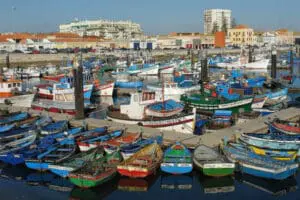
A study published in the recent issue of the ICES Journal of Marine Science reveals serious risks to food security in the Persian Gulf, where several nations are reportedly overfishing and under-reporting their catches. The team of scientists out of the University of British Columbia in Vancouver used images taken by Google Earth to identify the overfishing issue.
According to the Atlantic, “The official numbers are nothing but one big fish tale. Researchers Dalal Al-Abdulrazzak and Daniel Pauly estimated the fish catch in 2005, for instance, was 31,433 tonnes, six times what nations bordering the Persian Gulf reported.” The study authors wrote, “Our results document the unreliability of catch data from the Persian Gulf, a small part of a global misreporting problem.”
By under-reporting fish catches, the nations put their food security at risk, as well as the nation’s economy and marine ecosystems, note the researchers. “This is particularly important in the case of the Persian Gulf, where fisheries are the second most important natural resource after oil.”
“The scientists used a Google ruler tool to measure the size of each weir’s traps and then calculated daily fish catch based on historical records, the length of the fishing season and composition of fish species, such as mackerel, crab, lobster and sardines, at each location,” reports the Atlantic.
The discovery is just the latest use of Google Earth’s satellite image technology. According to the Atlantic, it’s also been used to monitor illegal logging activity in remote locations.
Keep in touch with Jill on Twitter @jillettinger
Related on Organic Authority
Get Off the Gill: 99 Reasons to Stop Eating Fish
Contaminated Water at Fukushima Can’t Be Contained, Pacific Faces Serious Danger
EU Expected to Pass Overfishing Policy Reform to Save Regional Fish Populations
Image: fotografar